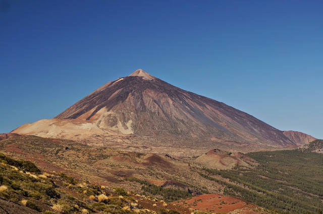
Pico del Teide, Tenerife, Spain, 3718m
29th September 2014
Google map link
Route: Sendero No. 7: Montana Blanca-Pico Teide
Total Elevation gain: 1365m
Total distance hiked: ~8km
Trek synopsis: 28th-29th September 2014
Day 1: Trailhead carpark (2350 m) of Sendero No. 7: Montana Blanca-Pico Teide - Refugio Altavista (3260 m).
Day 2: Refugio Altavista (3260 m) - Summit - Teide cable car upper station (descend by cable car)
Pico del Teide is located on the island of Tenerife, which is part of the Canary islands, off the coast of Africa. It is the highest peak in Spain.
We climbed Teide as part of the 4th Summit Summit, an annual celebration of Science and Mountains.
Google map link
Route: Sendero No. 7: Montana Blanca-Pico Teide
Total Elevation gain: 1365m
Total distance hiked: ~8km
Trek synopsis: 28th-29th September 2014
Day 1: Trailhead carpark (2350 m) of Sendero No. 7: Montana Blanca-Pico Teide - Refugio Altavista (3260 m).
Day 2: Refugio Altavista (3260 m) - Summit - Teide cable car upper station (descend by cable car)
Pico del Teide is located on the island of Tenerife, which is part of the Canary islands, off the coast of Africa. It is the highest peak in Spain.
 |
| Pico del Teide |
 |
| The sun at dawn, the shadow of Teide. |
 |
| Part of the group, at the summit |


Comments
Post a Comment