Mount Kenya, Lenana Point, 4985m
Google map link
Route: Sirimon Trail
Total Elevation gain: 2335m
Total distance hiked: ~51km
Trek synopsis: 19th-22nd August 2014
Sirimon Trail (Gate (2650m)to Old Moses (3390m), 9km (1st Night); Old Moses to Shipton (4260m), 13.6km (2nd Night); Shipton to Lenana, 2.6km, and back to Old Moses (3rd Night).
 |
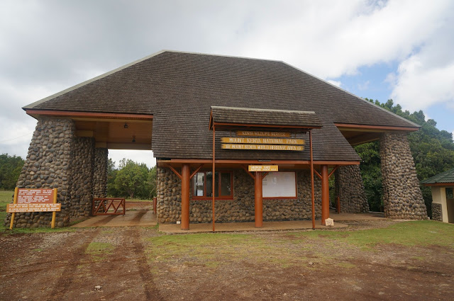
| Sirimon Gate. Start of the trail at 2650m |
Day 1
We met up with our guide Francis and cook John in Nanyuki town.
A dirt track turns off the Nanyuki-Meru main road (about 10km from Nanyuki) that finally leads to the Mount Kenya National Park Entrance (2650m). This is the start of the trek in, using the Sirimon trail. At about noon, we begun. Not too long after that, we crossed the equator.
 |
| Cheryl and Francis, at the equator marker.... |
 |
| ...while I was busy ascertaining that we had indeed crossed the equator. |
Most of the day's hike was on a 4WD trail with very gradual slopes. We reached Old Moses camp at about 4.10pm. It's a decent shack. Sitting on a small knoll, it has a grand view. Near sunset, lines of the sun stream down through the clouds, and lit up the plains below, and coloured it gold.
 |
| Old Moses Camp (3390m according to my GPS receiver). You can see the two highest summits of Mt Kenya (Batian and Nelion) peeking out from the slopes behind. |
Day 2
We started at 7.50am. Half of the trek today goes through the lovely MacKinder Valley which the Liki river runs through. The vally was named after Halford MacKinder, the expedition leader who made the first successful Mt Kenya ascent in 1895. MacKinder is more famous for his "The Geographical Pivot of History" which essentially gave birth to the field of geopolitics. The V-shaped valley gradually became a U-shaped valley as we walk upstream. It started to rain the last few km of the hike, and we were glad to reach Shipton's camp (4250 m) at 4.15pm.
We started our climb at 3.50am, and reached Point Lenana at 6.50am. The weather was clear, and not very windy. The steep walls of Nelion, the second highest point of Mt Kenya, dominates our view west and seems to dwarfed Lenana point. The jagged peaks and irregular mountain features around are very different from the clean and striking profiles of younger stratovolcanoes like Killimanjaro or Fuji. Age (Mt Kenya is at least 3,000,000 years old) has worn this mighty volcano (once taller than Killimanjaro during its prime) down, and only the more hardy volcanic plugs remain.
 |
| At the very not-quite top of Mount Kenya |
 |
| Nelion, the second highest summit of Mt Kenya. Batian, the highest peak is hidden behind Nelion |
 |
| View North, towards the head of the MacKinder Valley. Shipton's camp can be seen near the middle of the picture. |
 |
| Northwest View. Chogoria route direction |
 |
| The view of Point Lenana, on the way down |
 |
| View of Lenana Point from Shipton's camp |
 |
| MacKinder Valley, on the way back to Old Moses Camp. |
Day 4
Walk out to Sirimon gate. Slow and easy. Hoping to catch sight of some elephants that roam about in the forest, but never seeing any. We did find plenty of their digestive remains along the way...


Comments
Post a Comment