25th August 2014
Google map link
Route: Standard Route
Total Elevation gain: 620m
Total distance hiked: ~5.1km (3.1 km to the rim and a further 2.0 km to the summit)
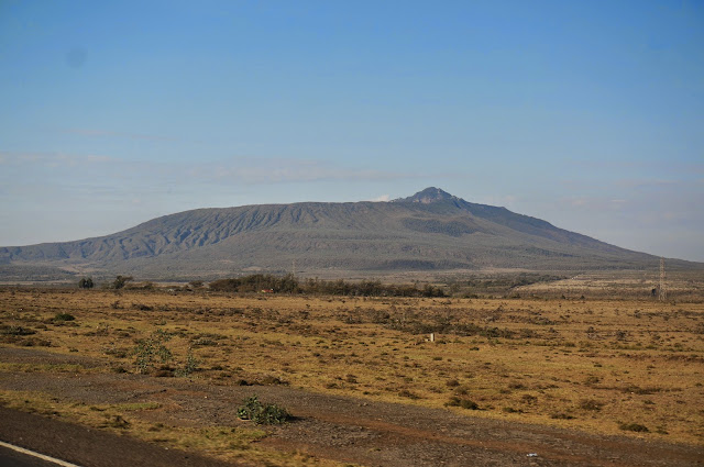
Mount Longonot is located in the Kenyan Rift Valley. It is a stratovolcano that blew its top off about 20,000 years ago. Its a relatively easy hike with a wonderful view of the Rift Valley landscape, including Lake Naivasha and Hell's gate.
 |
| Mt Longonot from the Old Naivasha Road |
 |
| At the start of the trek |
 |
| Cheryl and our guide Annie on their way towards the mountain |
The hike starts gradually through grasslands and shrubs on the lower slopes. Giraffes and buffaloes roam amongst the landscape. After a while, the climb gets a bit steeper before getting onto the crater rim.
 |
| At the Oloonongot crater rim. The summit peak can be seen behind the sign. |
We then follow the rim trail in the counter-clockwise direction to reach the summit. The trail is well defined, but at points, there may be a bit of exposure and the grounds at some slopes are slightly loose.
 |
| In the foreground, a volcanic vent. In the background, Lake Naivasha. Views from the rim trail. |
We started our hike at 8.55am and reached the summit at about 11am.
 |
| View of the crater from the summit. |
 |
| At the summit. |


Comments
Post a Comment