Mt Serapong, Sentosa (Pulau Blakang Mati), Singapore, 85 m

Route: via Serapong Hill Road
Starting elevation: ~5 m
Elevation gain: +80 m
Hike distance (one way): 1.1 km
Click here for GPS track
Its the 75th anniversary of V-J (Victory over Japan) day, and we decided to visit WWII military relics atop Mt Serapong. Furthermore with the COVID19 situation, there is probably not much overseas peakbagging chances available this year, and I turn my sights to peakbag Singapore Hills.
We parked our car at Sentosa Cove Village carpark, and walked back up along Allanbrooke road till a road opening to the right. You can't miss this road opening (Woolwich Road) as you will immediately see the massive Sentosa Satellite Earth station complex.

About 10 metres in, on the right, "Serapong Hill Road" led upward.

The tar road goes gently up. On the right through occasional breaks in the thick foliage, one can catch views of Singapore downtown from a perspective not often seen.

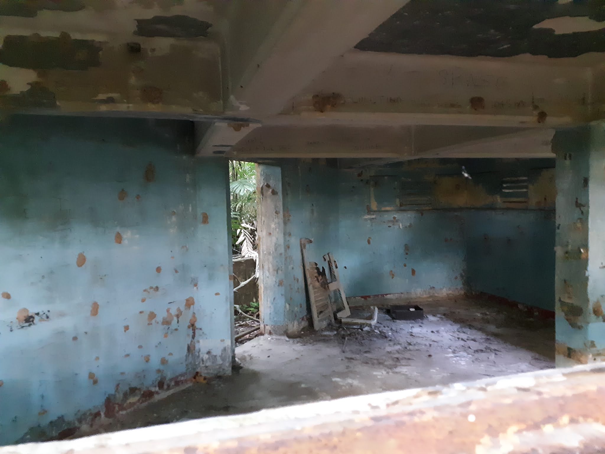
We eventually reach Serapong artillery battery area, with some decrepit buildings on the left, followed by a larger series of building that have been refurbished as storerooms. Built in 1936, these were originally barracks and dining hall for the fort.

 |
| Someone drew a chemical structure of Tryptamine on the wall. Perhaps the guy was high on some hallucinogenic drugs... Tryptamine, and closely related molecules are known to be neurotransmitters in the human brain. |
 |
| The buildings here are of 1936 vintage. |

The dirt path is obvious to follow, and not too long after, we saw the most impressive bit of the fort, which are the casemate buildings

A brief history of the summit of Mt Serapong is probably appropriate here. The casemates here date back to the late 19th century when the summit of Mt Serapong was first used to house an artillery battery. The original guns, were a pair of 8 inch guns, which were later replaced by 9.2 inch guns in 1910 (We will see the emplacements for these guns later). In the 1930s, however, these guns became obsolete and were removed. The summit of Mt Serapong was then converted to become the Battery Observation Post (BOP) for the series of more modern 9.2 inch guns at the foot of Mt Serapong at the Fort Connaught battery (nowadays peacefully embedded in Tanjung golf course). There are also a couple of 6 inch guns from 1930s vintage (comprising Serapong spur battery) nearby. For more details, check out this website about everything and more about the fortifications on Sentosa island.
Continuing past the casemate, the path leads on, round a bend to another building...

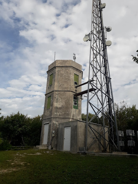
This is the BOP for the Fort Connaught battery that I mentioned earlier. The highest point of Sentosa is right behind the BOP and can be reached by bashing through some vegetation.
 |
| The Highpoint of Sentosa island, Mt Serapong. Not much view here, but the command post being eaten up 'Ta Prohm 'style is an interesting sight. |
 |
| Interior of the BOP |
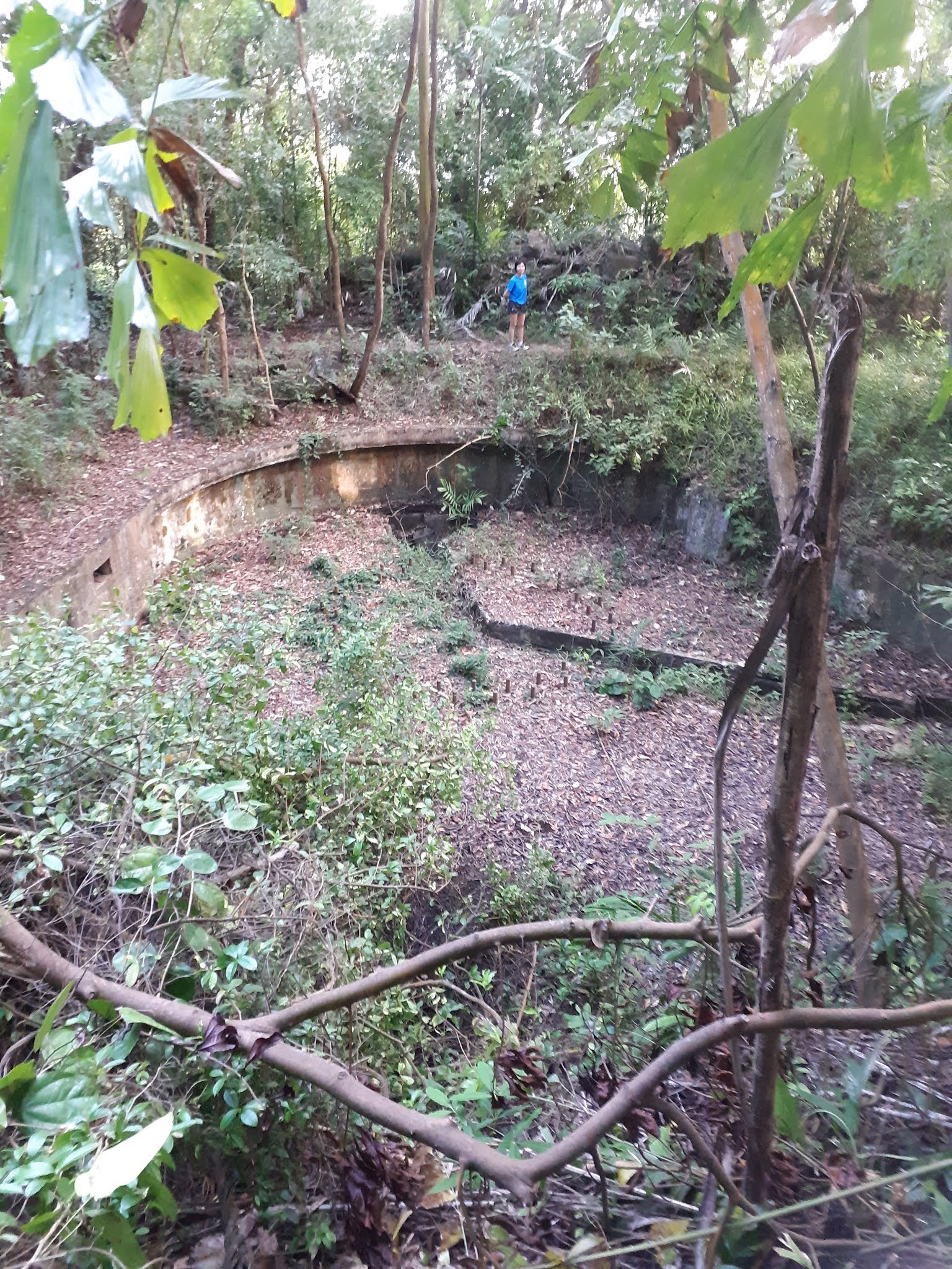
Beside the BOP is a large hole that was originally the emplacement for the 9.2 inch guns dating back to 1910. Apparently this emplacement was filled in in the 1930s when the BOP was built and was only excavated in the 2000s.

There are quite a bit of things to explore, and multiple paths amidst the ruined buildings. There is also a half decent view of the south down a large granite surface. However, while walking around, beware of rusted pipes, grass covered holes and drains.
Comments
Post a Comment